


ADDISON 56 Voting District, DuPage County, Illinois
About
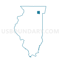
Outline

Summary
| Unique Area Identifier | 570528 |
| Name | ADDISON 56 Voting District |
| County | DuPage County |
| State | Illinois |
| Area (square miles) | 2.43 |
| Land Area (square miles) | 2.38 |
| Water Area (square miles) | 0.05 |
| % of Land Area | 97.85 |
| % of Water Area | 2.15 |
| Latitude of the Internal Point | 41.91169530 |
| Longtitude of the Internal Point | -88.01046630 |
Maps


Graphs
Select a template below for downloading or customizing gragh for ADDISON 56 Voting District, DuPage County, Illinois


Neighbors
Neighoring Voting District (by Name) Neighboring Voting District on the Map
- ADDISON 11 Voting District, DuPage County, IL
- ADDISON 34 Voting District, DuPage County, IL
- ADDISON 48 Voting District, DuPage County, IL
- ADDISON 53 Voting District, DuPage County, IL
- ADDISON 57 Voting District, DuPage County, IL
- BLOOMINGDALE 44 Voting District, DuPage County, IL
- MILTON 26 Voting District, DuPage County, IL
- YORK 100 Voting District, DuPage County, IL
- YORK 113 Voting District, DuPage County, IL
- YORK 42 Voting District, DuPage County, IL
- YORK 54 Voting District, DuPage County, IL
- YORK 73 Voting District, DuPage County, IL
Top 10 Neighboring County Subdivision (by Population) Neighboring County Subdivision on the Map
- York township, DuPage County, IL (123,449)
- Milton township, DuPage County, IL (117,067)
- Bloomingdale township, DuPage County, IL (111,899)
- Addison township, DuPage County, IL (88,612)
Top 10 Neighboring Place (by Population) Neighboring Place on the Map
Top 10 Neighboring Elementary School District (by Population) Neighboring Elementary School District on the Map
- Addison School District 4, IL (37,309)
- Villa Park School District 45, IL (36,731)
- Lombard School District 44, IL (34,968)
- Glen Ellyn School District 41, IL (28,833)
- Marquardt School District 15, IL (25,839)
Top 10 Neighboring Secondary School District (by Population) Neighboring Secondary School District on the Map
Top 10 Neighboring State Legislative District Lower Chamber (by Population) Neighboring State Legislative District Lower Chamber on the Map
- State House District 46, IL (107,630)
- State House District 42, IL (106,361)
- State House District 45, IL (105,943)
Top 10 Neighboring State Legislative District Upper Chamber (by Population) Neighboring State Legislative District Upper Chamber on the Map
Top 10 Neighboring 111th Congressional District (by Population) Neighboring 111th Congressional District on the Map
Top 10 Neighboring Census Tract (by Population) Neighboring Census Tract on the Map
- Census Tract 8432, DuPage County, IL (5,411)
- Census Tract 8409.08, DuPage County, IL (4,381)
- Census Tract 8466.03, DuPage County, IL (4,261)
- Census Tract 8409.04, DuPage County, IL (4,251)
- Census Tract 8467.01, DuPage County, IL (4,163)
- Census Tract 8467.02, DuPage County, IL (4,126)
- Census Tract 8417.06, DuPage County, IL (4,113)
- Census Tract 8433.01, DuPage County, IL (4,049)
- Census Tract 8466.04, DuPage County, IL (3,846)
- Census Tract 8434, DuPage County, IL (3,474)